

Just because we prefer open-source it doesn’t mean we want to hunt down datasets for the stories we are developing. The plug-ins for QGIS are many and there are some that are deserving of a little more love.
For example, multi-temporal analysis is built right into the semi-automatic classification plugin or SCP. The one caveat? It needs to be updated regularly as it relies on dependencies. I give you, the ‘remotior_sensus’ error. Not to worry. This is a python package allowing processing of remote sensing images.

The quick fix for me was to confirm the update was happening in the right path.
Head to Terminal and activate your environment. Once you get to the right path with QGIS, run the upgrade.
MacBook-Pro-3:~ bonnymcclain$ conda activate minimal_ds
(minimal_ds) MacBook-Pro-3:~ bonnymcclain$ /Applications/QGIS.app/Contents/MacOS/bin/pip3 install --upgrade remotior-sensus scikit-learn torch***if you are not on an Intel Mac you will need python version compiled for ARM
Ask me how I know lol.
(minimal_ds) MacBook-Pro-3:~ bonnymcclain$ eval "$(/opt/homebrew/bin/brew shellenv)"(minimal_ds) MacBook-Pro-3:~ bonnymcclain$ brew install python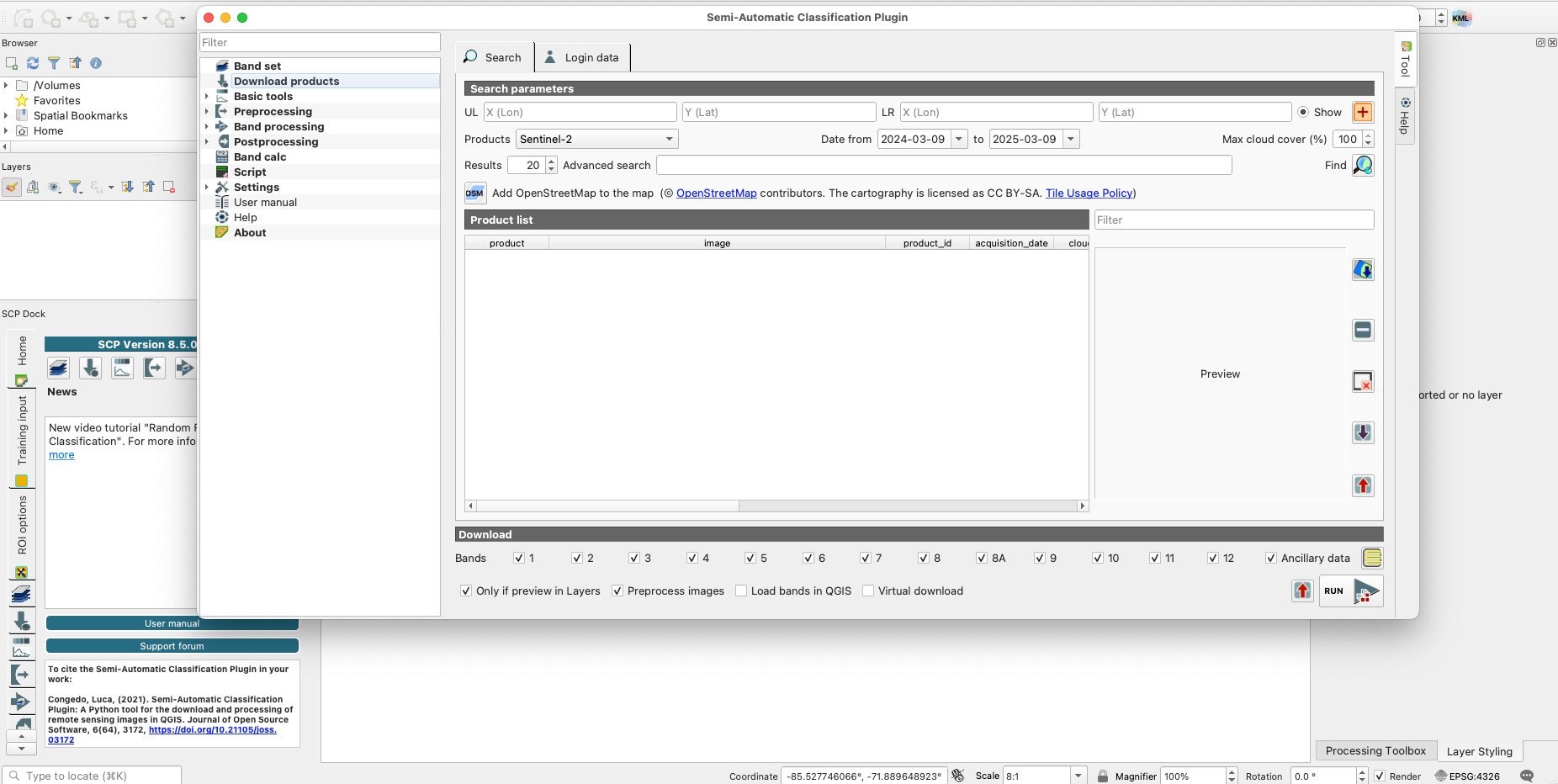
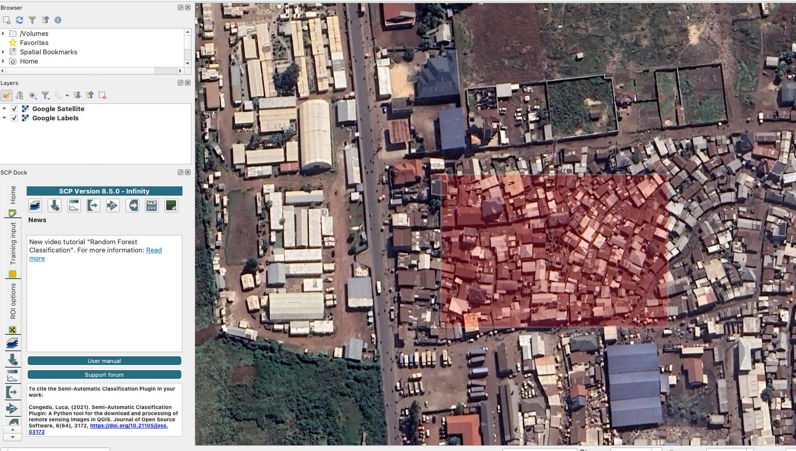
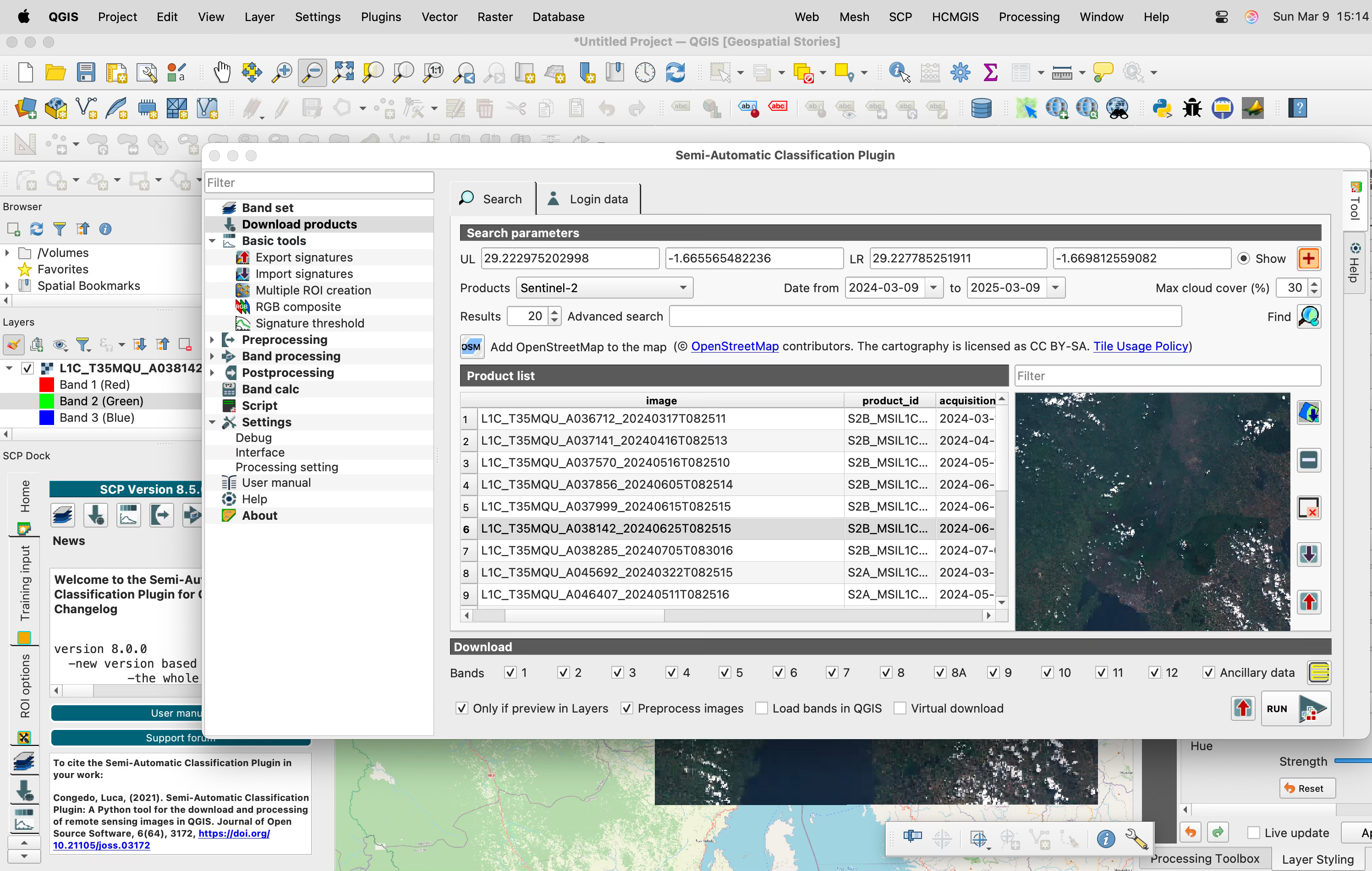
Once we hit the red ‘+’ in upper right corner we have a cursor we can use to trace our area of interest. It is highlighted in red below.
Now we find the products by selecting the magnifying glass on the right. Once the images populate they can be previewed in the window or downloaded onto the QGIS canvas.
Now that you know how to download the images, stay tuned to see how we can manipulate them using the Band set and Basic Tools.

